Punta Arenas, Chile | Photo Walk Location Guide
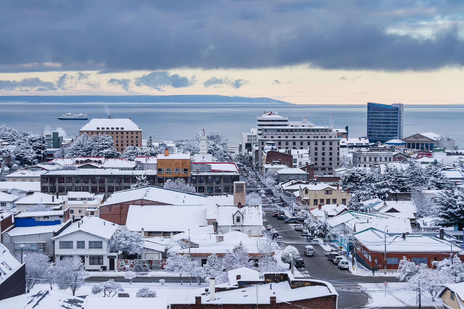
Photographers Travel Guide to explore Punta Arenas, Chile.
Originally founded as a penal colony by the Chilean government in 1848, Punta Arenas has grown and developed to become one of the most important cities in Patagonia.
At present, it is a city chosen by travelers and tourists to start their visit to Patagonia, and also by scientists and researchers before reaching Antarctica.
This travel guide to Punta Arenas is an invitation to take the time to explore, learn, and photograph the city, considering its history and heritage.
Punta Arenas Travel Guide & Photography Locations
a.- Benjamín Muñoz Gamero Main Square
The Punta Arenas’ main square —surround by historic buildings and palaces— it’s one of the best starting points to explore the city. The prevailing neoclassic architectural style is a living memory from a thriving commercial era. Here, you will get the first approach to the city’s history and heritage.
Before the opening of the Panama Canal, in 1914, the Strait of Magellan was part of the primary route for interoceanic trade between the Atlantic and the Pacific Ocean. At the same time, Punta Arenas was one of the most important port cities in South America.
Under those circumstances, some immigrants found commercial opportunities by developing maritime and sheep farming enterprises. Some old buildings, around the main square, reflect the exponential economic growth experienced during that time.
Photo Tip: The main square and surroundings are the right places to practice architecture and urban photography. I recommend you taking the time to observe all the details in the buildings, try unique perspectives, and get creative with your composition.
© Eduardo Paredes Morales
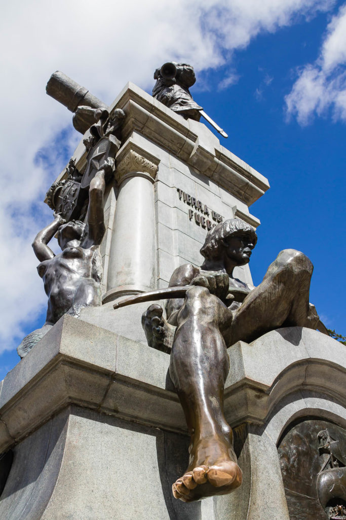
Monument to Ferdinand Magellan
Canon 7D @ 18 mm – f / 8.0 – 1/250 seg. – ISO 125
© Eduardo Paredes Morales
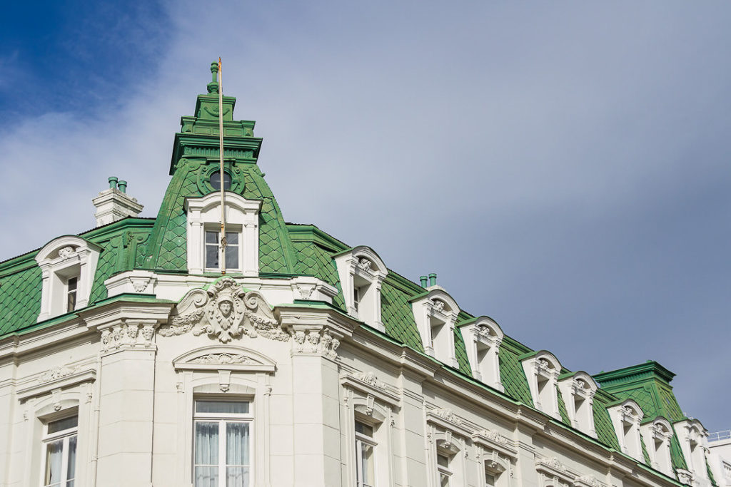
Braun & Blanchard building
Canon 7D @ 35 mm – f / 8.0 – 1/250 seg. – ISO 100
© Eduardo Paredes Morales
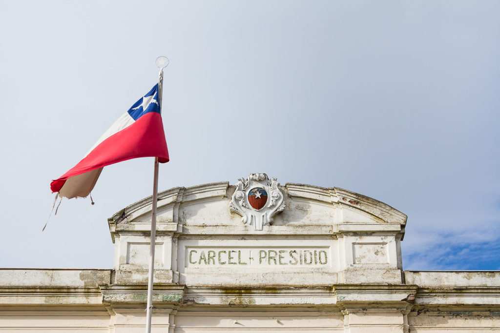
Punta Arenas’ old prison
Canon 7D @ 42 mm – f / 8.0 – 1/250 seg. – ISO 160
b.- ‘Cerro de la Cruz’ Viewpoint
From the main square, you can get access to the best viewpoint in town. To get there, just walk four blocks westbound on Fagnano street (going in the opposite direction to the Strait).
Here, you can take panoramic pictures of most of the city, having the Strait of Magellan and Tierra del Fuego island as a unique background.
Photo Tip: This location is especially interesting for panoramic photography during sunrises and sunsets. At sunset, you’ll have the Sun in your back, with the help of a few clouds, you might get a panoramic view of Punta Arenas full of colors.
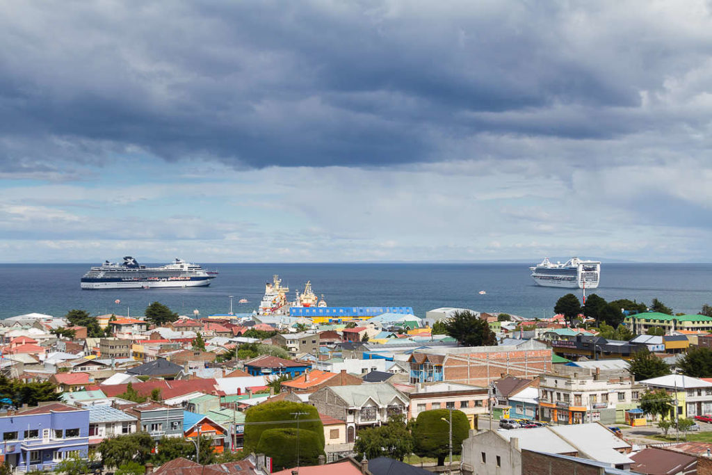
© Eduardo Paredes Morales
Cerro de la Cruz
Canon 7D @ 35 mm – f / 8.0 – 1/250 seg. – ISO 100
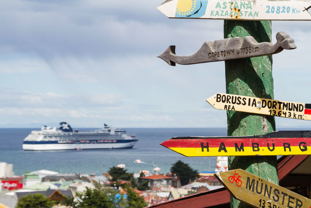
© Eduardo Paredes Morales
Cerro de la Cruz
Canon 7D @ 78 mm – f / 8.0 – 1/200 seg. – ISO 100
c.- Promenade and the Strait of Magellan
The promenade is another traditional location in Punta Arenas. It goes from north to south, next to the Strait of Magellan, with a bike lane throughout most of its extension, making it very easy to go from one city extreme to the other.
Along its 6 miles of distance (10 km), you will find some historic piers, old ships, and other attractions, part of the city’s identity.
Photo Tip: The weather of this region offers photography opportunities for practicing long-exposure photography. With the help of neutral density filters, the clouds and the waves can have a great impact on your composition.
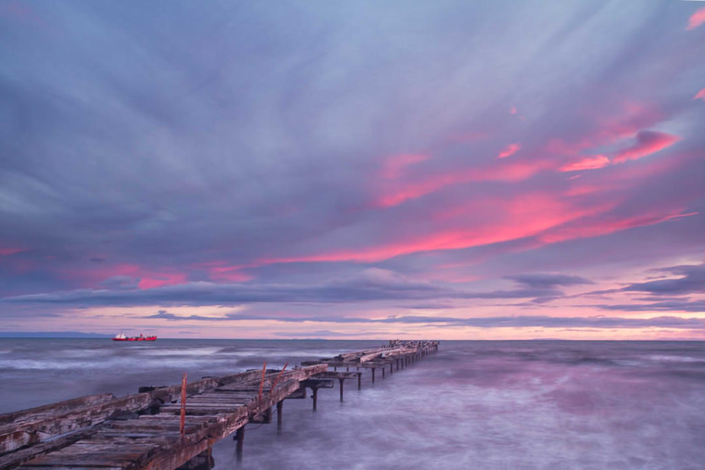
© Eduardo Paredes Morales
Loreto dock
Canon 7D @ 18 mm – f / 6.3 – 6 seg. – ISO 100
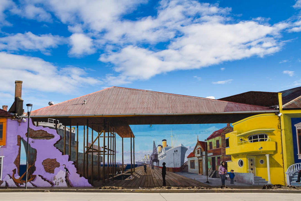
© Eduardo Paredes Morales
Architectural mural, Punta Arenas promenade (September 2012)
Made by Fernando Padilla Arrau, Luis Pérez López, and Víctor Nova Vásquez
Canon 7D @ 24 mm – f / 7,1 – 1/160 seg. – ISO 100
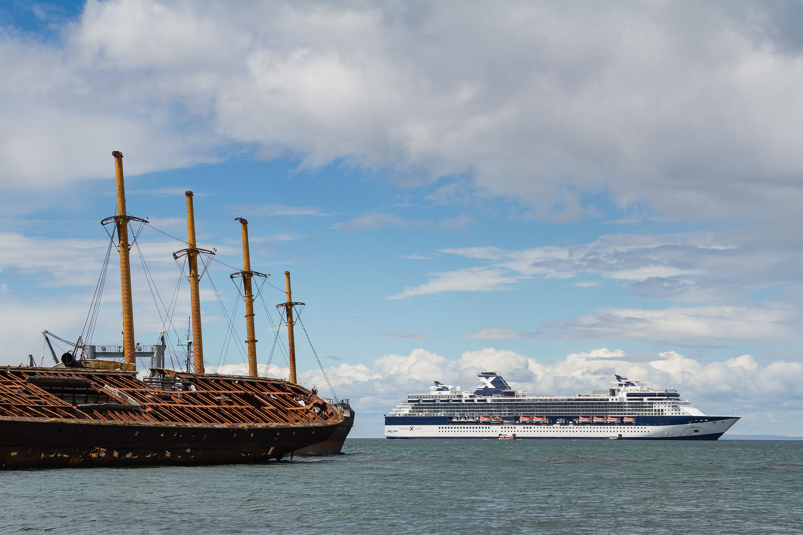
© Eduardo Paredes Morales
Hulks at Punta Arenas’ promenade
Canon 7D @ 18 mm – f / 9 – 1/250 seg. – ISO 160

© Eduardo Paredes Morales
Monument to the South
Canon 7D @ 18 mm – f / 9 – 1/250 seg. – ISO 160
d.- Sara Braun Cemetery
Punta Arenas has been a cosmopolitan city since its begging. People coming from the south of Chile and immigrants mainly from Europe helped to develop the first decades of the city and Patagonia.
The public cemetery —established in 1894— represents the cultural diversity that shaped Patagonia, since the end of the XIX and throughout the XX century. CNN chose this cemetery as one of the most beautiful in the world.
Photo Tip: With some historical background, you will experience this place differently, getting to photograph new perspectives and compositions that reflect the local history.
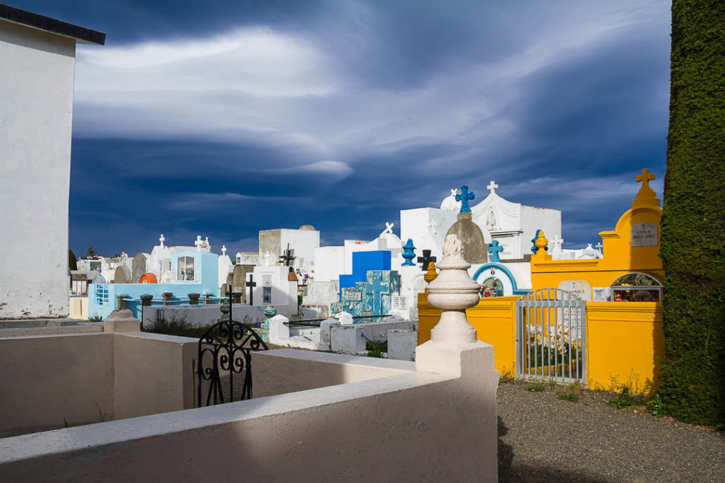
© Eduardo Paredes Morales
Punta Arenas’ cemetery
Canon 7D @ 18 mm – f / 8 – 1/250 seg. – ISO 100
e.- ‘Tres Puentes’ Wetland
At the north entrance of Punta Arenas, you can find this urban nature reserve. It’s an exceptional place to observe and photograph different species of birds, that during summer use this wetland as a breeding and feeding area.
Photo Tip: If you are not carrying a long-telephoto lens for bird photography, you can still enjoy this place by taking panoramic and broad views of the wetland, or by capturing groups of birds on their environment, being close to the avenue.
f.- Nao Victoria Museum
It is a private museum with full-size replicas of historic ships relevant to the sailing history of Patagonia and the Strait of Magellan.
The Replicas
The Nao Victoria was part of a five-ship Spanish fleet commanded by Ferdinand Magellan. This expedition discovered the passage between the Pacific and the Atlantic Ocean in the southern section of South America. Also, from the original fleet, she was the only ship to complete the first-time circumnavigation of the globe.
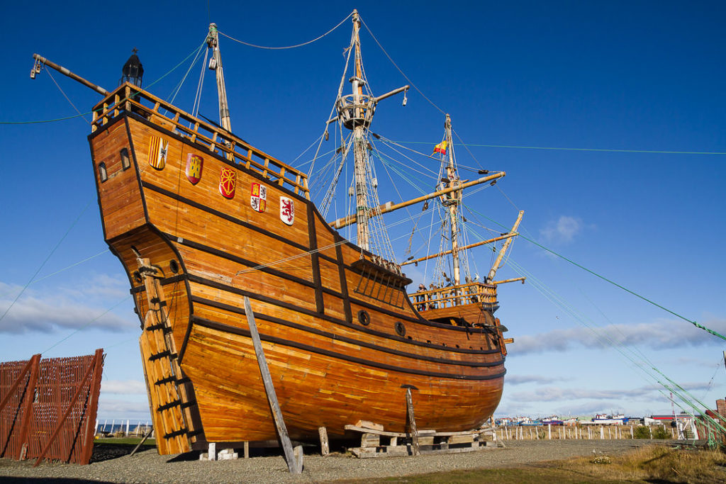
© Eduardo Paredes Morales
Nao Victoria
Canon 7D @ 18 mm – f / 8 – 1/250 seg. – ISO 100
The HMS Beagle was a British Navy brig-sloop converted into an exploration vessel. Its primary use was for exploring the remote islands, channels, and fjords of the southern coasts of Patagonia. The most famous exploration was her second voyage under the command of Captain Fitz Roy, and with Charles Darwin as a young naturalist.
On September 21st, 1843, the Schooner Ancud was the vessel used to claim the Strait of Magellan on behalf of the Chilean government. Onboard were the people who achieved to establish the first permanent colony in Patagonia.
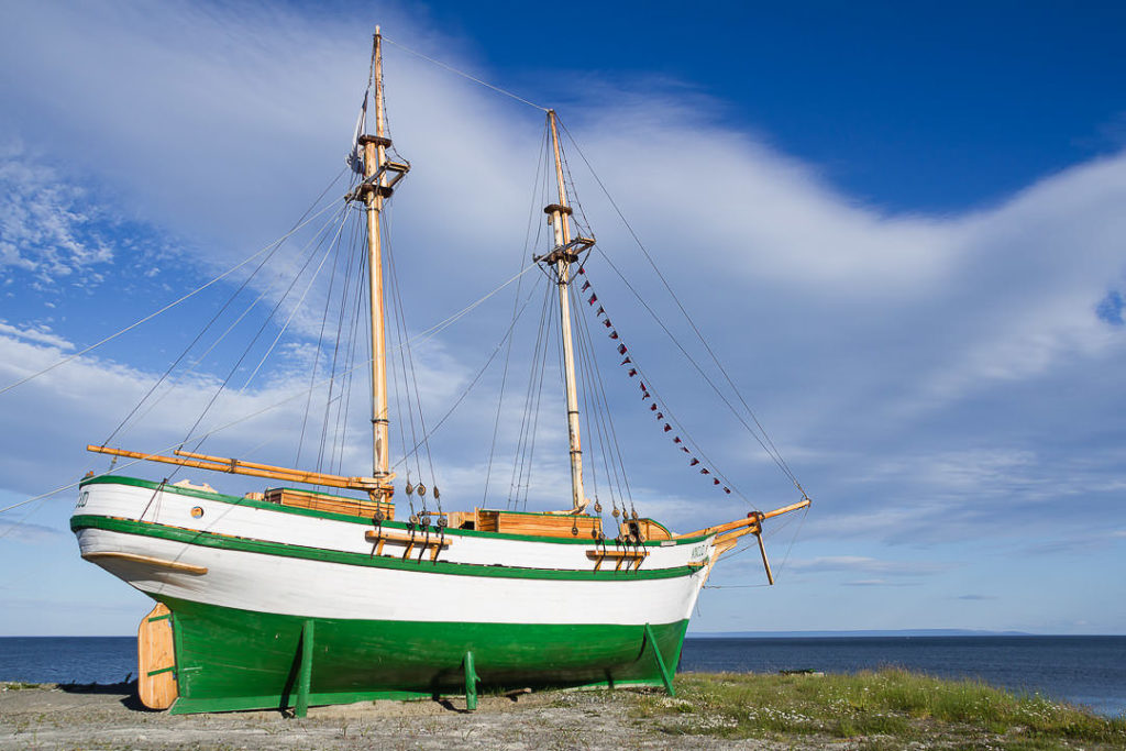
© Eduardo Paredes Morales
Schooner Ancud
Canon 7D @ 18 mm – f / 8 – 1/250 seg. – ISO 100
The James Caird was a lifeboat from the Endurance and the Imperial Trans-Antarctic Expedition (1914-1917). Ernest Shackleton used it to sail from Elephant Island to South Georgia, seeking help for rescuing the rest of his men, stranded on Elephant Island.
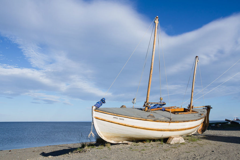
© Eduardo Paredes Morales
James Caird
Canon 7D @ 18 mm – f / 8 – 1/250 seg. – ISO 100
Important: This travel guide of Punta Arenas is for reference only. To perform this circuit in a self-guided way, it is the responsibility of each reader to complement this guide with additional information.
For more information, you can check the official website of the National Tourism Service in Chile: www.sernatur.cl

Recommended Posts
Mount Tarn, Chile | Photo Hike Location Guide
30 October, 2019
Cañadón Leona, encounter between archeology and geology in Patagonia
16 January, 2020

