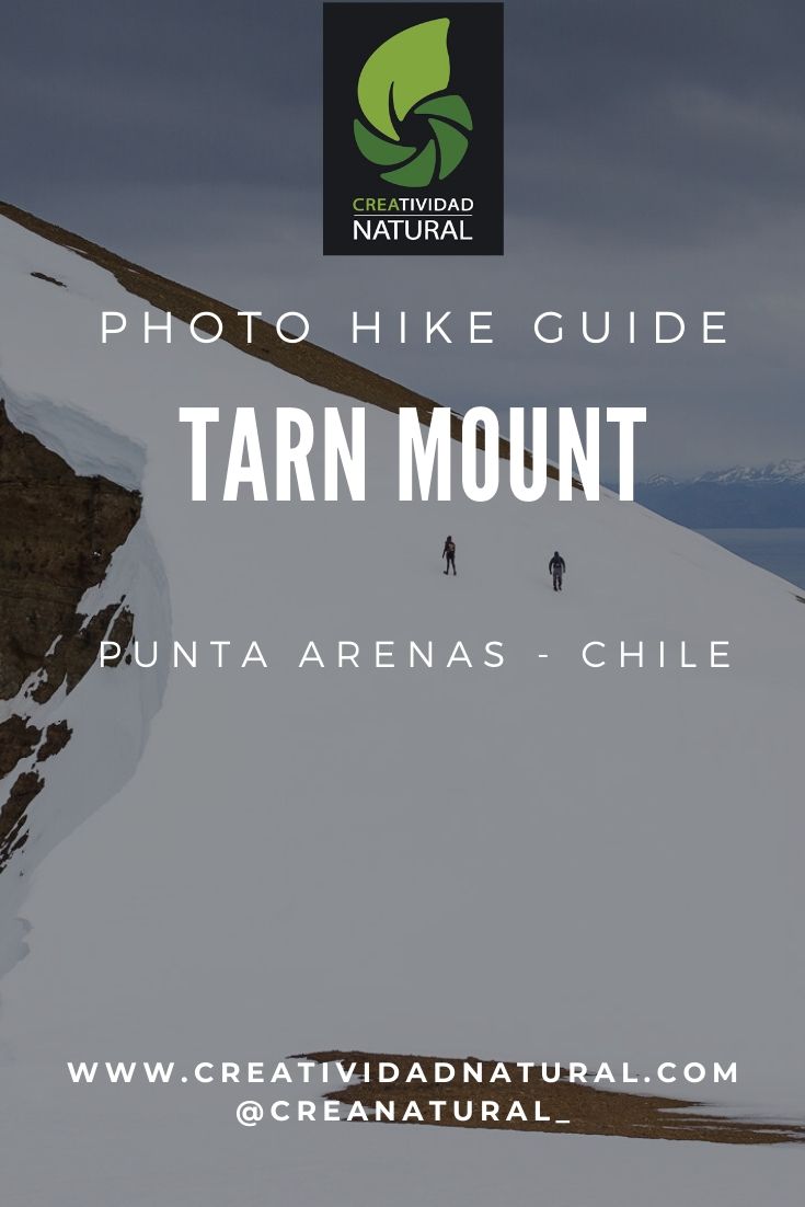
Mount Tarn, Chile | Photo Hike Location Guide
The Mount Tarn is located about 43 miles south of Punta Arenas. Its summit —with an altitude of 2.700 feet above sea level— dominates over the end of mainland South America.
It was named after surgeon John Tarn, the first one to reach its summit in February 1827. He was part of the first British hydrographic expedition in Patagonia, between 1826 and 1830. This expedition conducted a detailed study of the southern coasts in Patagonia, and because of the relevance of their works, part of the regional toponymy inherits some of their names.
Hike Details
It is a route suitable for people with basic knowledge in hiking and leaving no trace techniques or in the company of a specialized hiking guide.
The ascent includes a steep slope at the end of the path, exposed to strong prevailing winds from the west. During the winter months, the snow and ice cover much of the trail.
Ribbons and stakes partially mark the trail. For a safe ascent, I highly recommend the use of GPS with the marked route.
- Country: Chile.
- Closest city: Punta Arenas.
- Access: Free.
- First ascent: John Tarn, 1827.
- Difficulty: Medium to high difficulty.
- Elevation gain: 2,700 ft (815 mts).
- Extension: 8 miles round trip.
- Total hike’s duration: 8 hours in total.
Take into account:
- Give notice of your itinerary at the police outpost in Agua Fresca (kilometer 29, Route 9 South).
- Bring at least 1 liter of water.
- Use trekking poles.
- Before reaching the summit, caution with steep slopes, loose terrain, and strong winds.
- Prevent falls in the sectors with a greater slope.
- Near the summit caution with suddenly low visibility because of cloud cover.
- During the months of snow and ice accumulation along the path, use snowshoes and crampons.
- In case of abundant humidity in the peat zone, wear gaiter, along with carrying a change of shoes and socks for your return home.
- Always follow the trail marks and walk on a single footprint, to minimizing the impact and soil erosion.
Mount Tarn Hike’s Track
One of the major highlights of this hike is that starts from the sea level to the highest point of this area. So, it’s a perfect lookout to observe the end of mainland South America.
From the Tarn’s summit, it is possible to observe the Strait of Magellan, Dawson, and Tierra del Fuego Island, part of the Darwin Mountain Range, Mount Sarmiento, and much of the Brunswick Peninsula.
Powered by Wikiloc
Photo Hiking at Mount Tarn
© Eduardo Paredes Morales
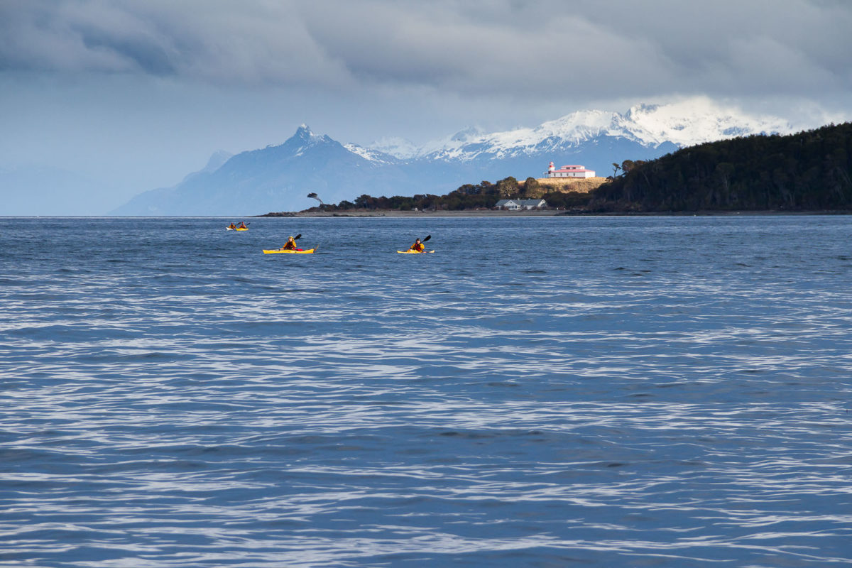
Kayaks on the Strait of Magellan, with San Isidro lighthouse in the background
Canon 7D @ 135 mm – f / 8.0 – 1/320 seg. – ISO 320
© Eduardo Paredes Morales
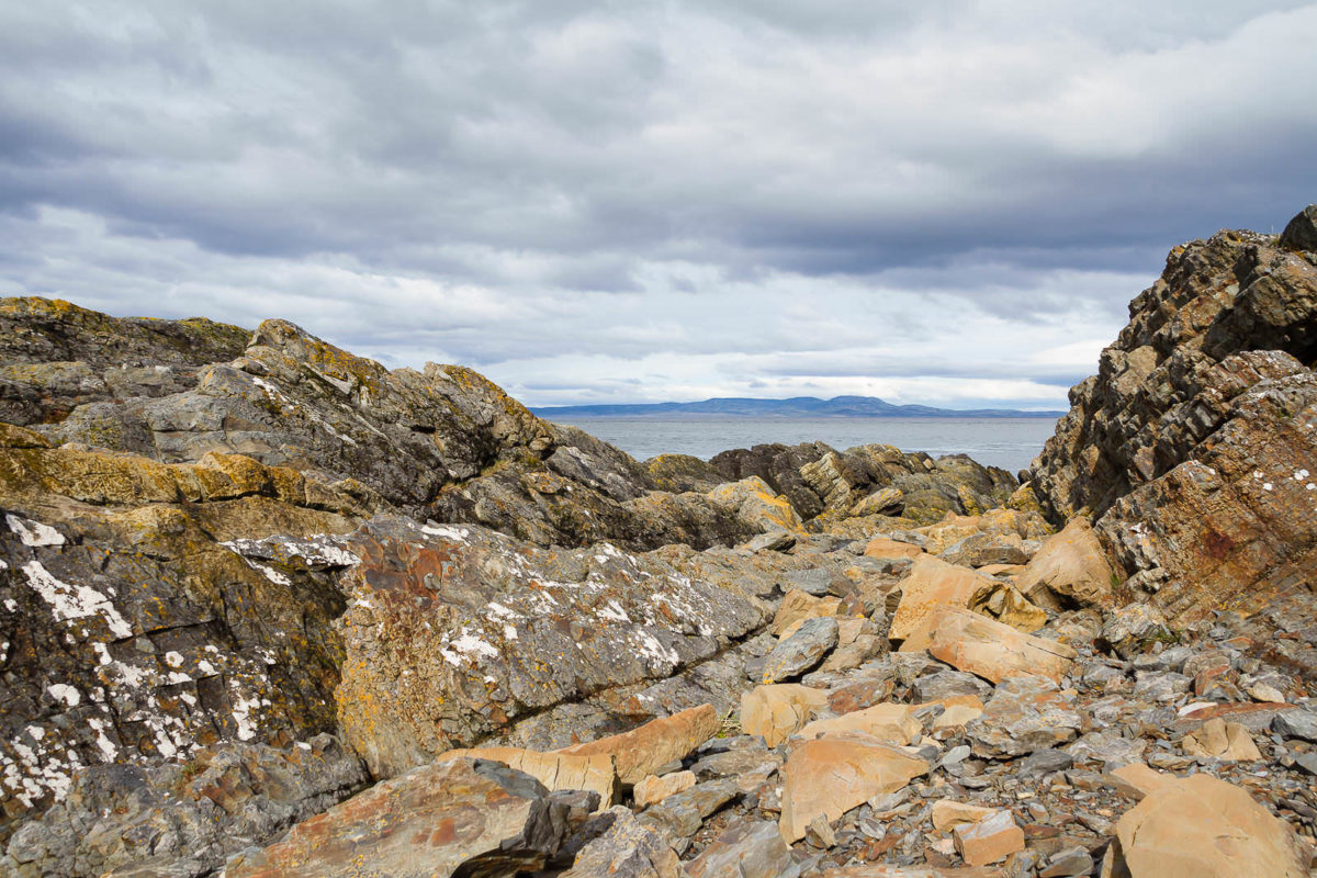
Intertidal geological composition at the base of Mount Tarn
Canon 7D @ 18 mm – f / 7.1 – 1/400 seg. – ISO 250
© Eduardo Paredes Morales
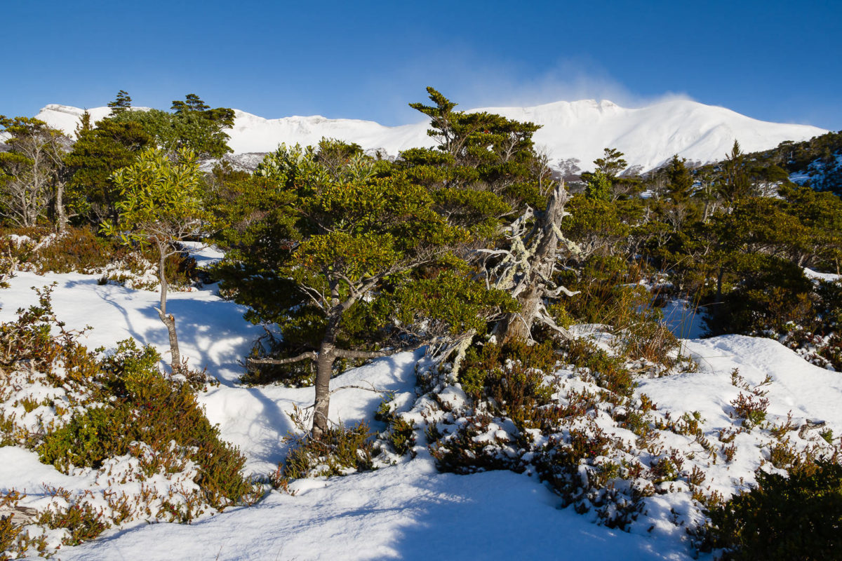
Evergreen forest, Mount Tarn east hillside
Canon 7D @ 18 mm – f / 8.0 – 1/320 seg. – ISO 100
© Eduardo Paredes Morales
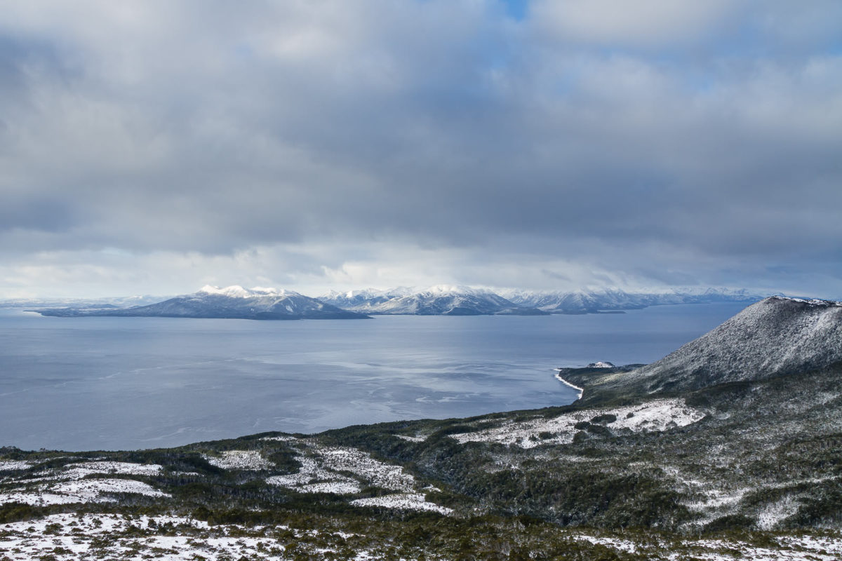
Panoramic view from the Mount Tarn of the Strait of Magellan and Dawson island
Canon 7D @ 18 mm – f / 8.0 – 1/80 seg. – ISO 200
© Eduardo Paredes Morales
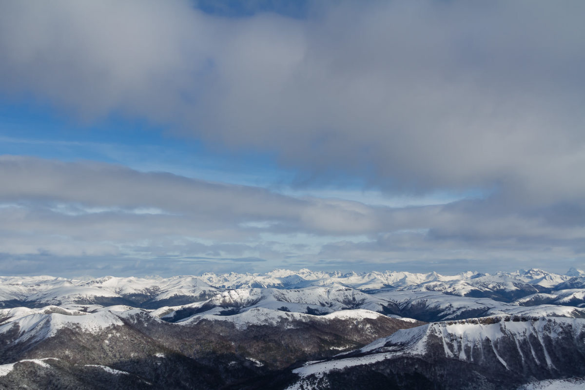
Westbound panoramic view from the top of Mount Tarn
Canon 7D @ 28 mm – f / 8.0 – 1/250 seg. – ISO 200
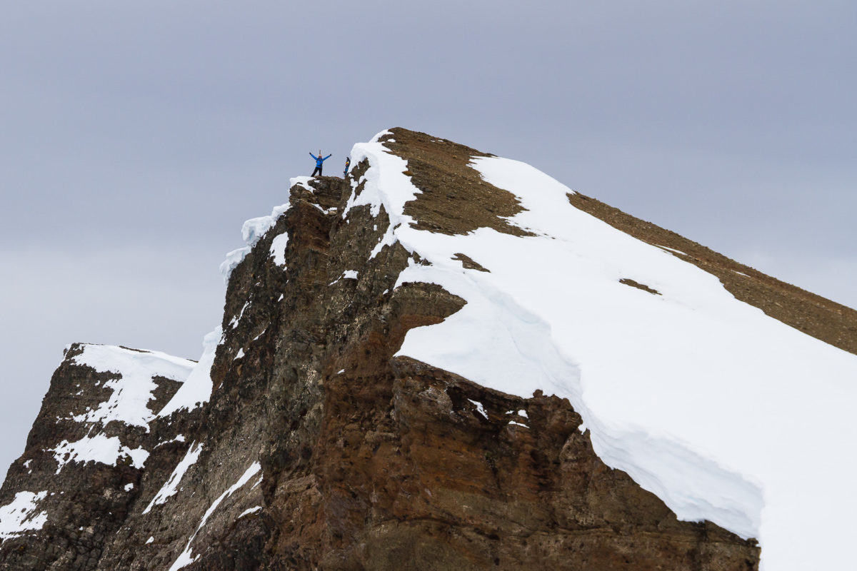
© Eduardo Paredes Morales
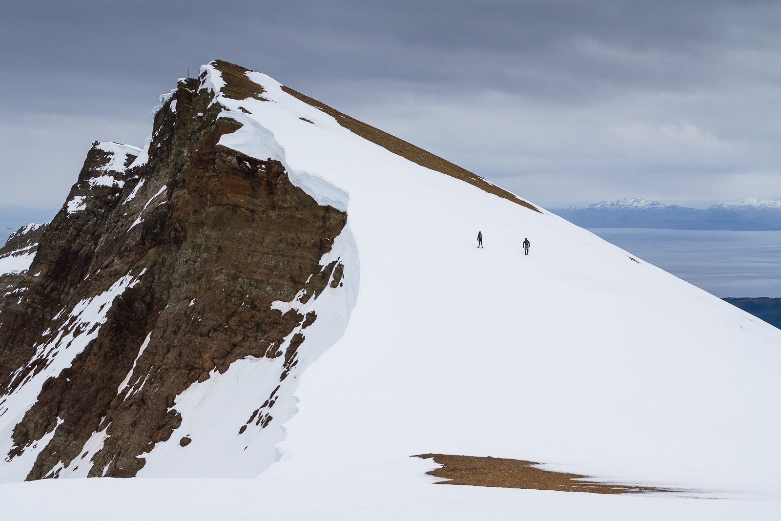
Mount Tarn’s summit
Canon 7D @ 32 mm – f / 8.0 – 1/400 seg. – ISO 200
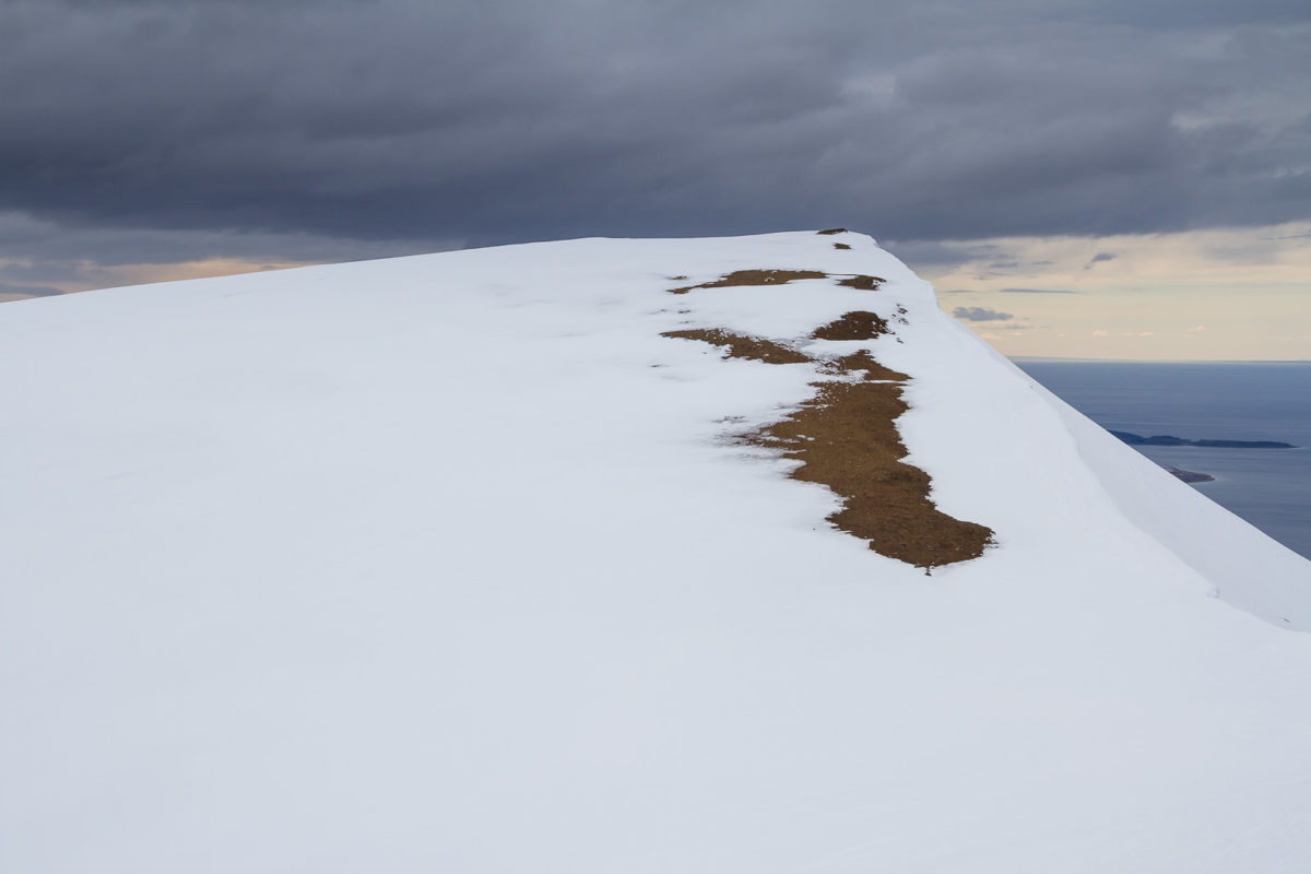
© Eduardo Paredes Morales
Tarn Mount’s summit
Canon 7D @ 32 mm – f / 8.0 – 1/400 seg. – ISO 200
The Mount Tarn, an opportunity for practicing leave no trace
Since the extension of the south road —starting from Punta Arenas—, the area of the Mount Tarn is receiving more and more visitors with different interests. Because it is an unprotected and free access area, it turned into an opportunity for developing a better awareness regarding the personal behavior of each individual visiting this natural environment.
For enjoying a safe and responsible experience, remember carefully planning your visit, hike within the trail, and bring back all your waste.

Important: This information is for reference only. To perform this circuit in a self-guided way, it is the responsibility of each reader to complement this guide with additional information. Also, you must have the proper knowledge and physical condition to function safely in natural environments.
Recent Posts
Cañadón Leona, encounter between archeology and geology in Patagonia
16 January, 2020
Punta Arenas, Chile | Photo Walk Location Guide
30 October, 2019